Park Meeting Round-Up – September meeting
Disclaimer: These are not the official minutes of the meeting, only a recollection of the highlights.
Oakland is one step closer to having a brand new park. Last night was a very exciting meeting which continued to demonstration the Great Spirit found within Oakland; when people of all different backgrounds work together for a common cause.
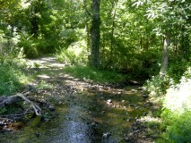
The meeting was highlighted by Boy Scout Eric Kozak, who dazzled the committee with an in-depth power-point presentation. Since the August meeting, Eric spent a good portion of his time gathering GPS data of the existing rudimentary trails which are presently located on the property. Eric went on the grounds and took photos of important areas as well as areas that may be troublesome. Part of his presentation included an aerial diagram of the park. He then created an overlay of potential walking trails. These trails would need only a little work. As a refresher, the committee will not allow any cutting down of brush or trees in trail creation; they will only allow the cleaning up of the rudimentary trails that already exist.
The trails on Eric’s diagrams traveled along the river, on both sides of the Little Pond Brook mouth, within Pleasureland and the back of Mueller’s Park. There is also a well-defined trail that connects the two areas. The GPS analysis showed the potential for acres of trails cut from the existing elementary trails; they need to be cleaned for safe hiking passage.
The next step, that Eric volunteered, would be to present a final working plan to the committee. This plan, as part of his Boy Scout project, will define all trails, install environmentally safe identifying markers and create an easy to read map for the public.
 Walking the path between the two trails areas one would have to cross the C-1 steam, Little Pond Brook. Because of the issues with the brook, people would have to walk through the over spill stream artery. The committee asked the borough engineer to investigate what is the DEP requirements to place a non-permanent bridge that has no the ground footings or foundations. This would enable hikers to cross the stream without entering it.
The committee discussed the new parking located within the Pleasureland area. It has been defined and would be a good location that allows many cars without disturbing any of the environment. Erik’s final presentation will include identifying how cars may enter through the Doty Road entrance and park in this parking lot (which is made up of hard compact dirt and barren of any plant life).
The “Name the Park” vote was also discussed. At present there are two names up for the election: “Pleasureland Park” and “Great Oak Park”. Over the next couple weeks more names may be entered, as the specifics will be announced on Debbie Sarcone’s blog website: NewOaklandPark.com.
The next meeting has been rescheduled for Wednesday October 9th, 8:00pm in the Danny D’Elia building. The committee is still very hopeful that the park can be open by the spring of 2014.
Remember School is Open Drive Carefully,
Mike Guadagnino
Chairman
Park Committee
Please follow the parks progress at NewOaklandPark.com
Are you on Twitter? Mike will be tweeting the park’s progress as well as all Oakland Recreation information on his twitter account: @MGuad27, follow him for the most up to date information.

As a hiker, i only pick trails that are a big big loop. I do not like walking to the end of a trail and turn around to go beack on the same trail.
A few months ago i saw early trail drawings, and saw most of the trails ended, and did not loop. I hope this can be fixed, as I would then use this new Park at least 3 times a week.
And the trails should have mile markers, so hikers can easily tell how they have walked.
Best Regards
Joe Hoffman Jr
I believe the plan presented by the Boy Scout includes only loops. If there are dead ends, they are short and to a significant feature or view. I believe all the trails will be marked with color blazes following standards used by the NY/NJ Trail Conference and a reference map (you are here) will be made and posted in the parking lot similar to most parks. I believe the goal is to duplicate the best practices used by the NY/NJ trail conference.
Martin is correct with everything he explained. The map from a few months ago only outlined main arteries, these were not the actual hiking trails. The next meeting will be Oct 9th, where the trails, markers etc will all be presented. Everyone in welcome to attend and/or join in the discussion.